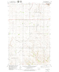
1979 Map of Tioga SW
USGS Topo · Published 1979About this map
The Beaver Lodge Oil and Gas Field dominates the landscape of Williams County in the late 1970s, illustrating the intense industrial footprint of the Williston Basin. Numerous Oil Wells, pipelines, and a Pumping Station are interspersed among the high plains, showing the intersection of energy extraction and traditional prairie life. In the southern reaches, the drainage of Dry Fork Creek carves through Farm Vale and Dry Fork, providing a sharp contrast to the geometric grid of access roads and drill sites above.
Find a feature on this map
15 named features on this map. Tap any name to fly to it.
Don’t see what you’re looking for? This feature index may not catch every label — zoom into the map to look around manually.
Map Details
Editions of this 1979 Tioga SW Map
This is the sole edition of this map. No revisions or reprints were ever made.
Other maps of this area

1911 · Ray
USGS Topo · 1:125,000

1953 · Williston
USGS Topo · 1:250,000

1957 · Williston
USGS Topo · 1:250,000

1965 · Charlson NE
USGS Topo · 1:24,000

1965 · Charlson NW
USGS Topo · 1:24,000

1969 · White Earth
USGS Topo · 1:24,000

1969 · Red Mike Hill
USGS Topo · 1:24,000

1978 · Ray SE
USGS Topo · 1:24,000

1978 · Temple
USGS Topo · 1:24,000

1979 · Tioga SE
USGS Topo · 1:24,000