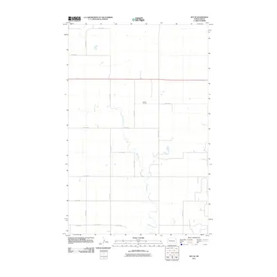
2011 Map of Ray SE
USGS Topo · Published 2011About this map
Beaver Creek meanders through this agricultural landscape in Williams County, creating a distinct riparian corridor that breaks the geometric regularity of the section-line road grid. The presence of the German Cemetery along 63rd St NW serves as a significant landmark for genealogists and local historians, anchoring the heritage of the rural community in this part of North Dakota. The transport network is defined by a rigorous grid of section-line roads, including 66th St NW and 112th Ave NW, which facilitate movement across the prairie. This survey also shows the primary regional artery of Route 2 cutting horizontally across the northern portion of the map, alongside local thoroughfares like County Hwy-17A, illustrating the modern infrastructure supporting the area's ongoing agricultural and industrial character.
Find a feature on this map
17 named features on this map. Tap any name to fly to it.
Don’t see what you’re looking for? This feature index may not catch every label — zoom into the map to look around manually.
Map Details
Editions of this 2011 Ray SE Map
This is the sole edition of this map. No revisions or reprints were ever made.
Other maps of this area

1911 · Ray
USGS Topo · 1:125,000

1953 · Williston
USGS Topo · 1:250,000

1957 · Williston
USGS Topo · 1:250,000

1965 · Charlson NW
USGS Topo · 1:24,000

1969 · Cussicks Spring
USGS Topo · 1:24,000

1969 · Red Mike Hill
USGS Topo · 1:24,000

1978 · Ray
USGS Topo · 1:24,000

1978 · Ray SE
USGS Topo · 1:24,000

1978 · Temple
USGS Topo · 1:24,000

1978 · Ray NW
USGS Topo · 1:24,000