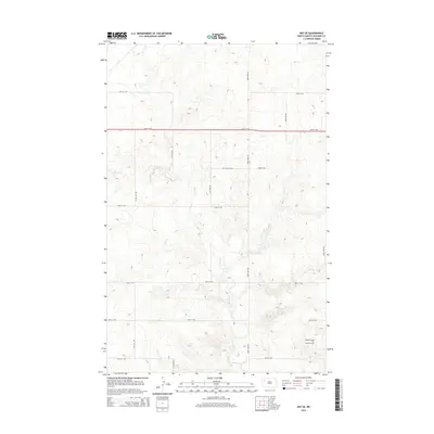
2014 Map of Ray SE
USGS Topo · Published 2014About this map
Beaver Creek carves a winding path through this portion of Williams County, creating a series of intricate coulees and draws that disrupt the otherwise orderly grid of section-line roads. This landscape reflects the industrial shift of the early 21st century, dominated in the southeast corner by the Beaver Lodge Oil and Gas Field. Amidst the modern energy infrastructure, quiet markers of earlier settlement remain, most notably the German Cem located near the intersection of 63rd St NW and 109th Ave NW. The network of gravel roads, including 112th Ave NW and 64th St NW, provides access to these isolated rural sites, showing a territory where agricultural traditions and natural drainage patterns meet the rising footprint of North Dakota's oil production.
Find a feature on this map
16 named features on this map. Tap any name to fly to it.
Don’t see what you’re looking for? This feature index may not catch every label — zoom into the map to look around manually.
Map Details
Editions of this 2014 Ray SE Map
This is the sole edition of this map. No revisions or reprints were ever made.
Other maps of this area

1911 · Ray
USGS Topo · 1:125,000

1953 · Williston
USGS Topo · 1:250,000

1957 · Williston
USGS Topo · 1:250,000

1965 · Charlson NW
USGS Topo · 1:24,000

1969 · Cussicks Spring
USGS Topo · 1:24,000

1969 · Red Mike Hill
USGS Topo · 1:24,000

1978 · Ray
USGS Topo · 1:24,000

1978 · Ray SE
USGS Topo · 1:24,000

1978 · Temple
USGS Topo · 1:24,000

1978 · Ray NW
USGS Topo · 1:24,000