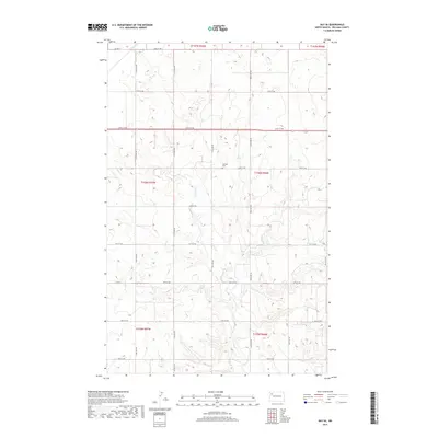
2017 Map of Ray SE
USGS Topo · Published 2017About this map
Beaver Cr meanders through the heart of this Williams County landscape, carving a network of drainages across the prairie. The area is defined by a rigid section-line grid of rural roads, including 64th St NW and 110th Ave NW, which facilitate access to the surrounding agricultural land. Near the center of the quadrangle, the German Cem sits as a quiet landmark of the local community's heritage, located just south of 63rd St NW. This 2017 survey reflects the enduring spatial organization of the North Dakota plains, where historical township boundaries like t156n r96w still dictate the placement of farmsteads and transport routes. Significant local thoroughfares such as Co Hwy 17 and Co Rd 8 provide the primary connections through this sparsely populated region.
Find a feature on this map
26 named features on this map. Tap any name to fly to it.
Don’t see what you’re looking for? This feature index may not catch every label — zoom into the map to look around manually.
Map Details
Editions of this 2017 Ray SE Map
This is the sole edition of this map. No revisions or reprints were ever made.
Other maps of this area

1911 · Ray
USGS Topo · 1:125,000

1953 · Williston
USGS Topo · 1:250,000

1957 · Williston
USGS Topo · 1:250,000

1965 · Charlson NW
USGS Topo · 1:24,000

1969 · Cussicks Spring
USGS Topo · 1:24,000

1969 · Red Mike Hill
USGS Topo · 1:24,000

1978 · Ray
USGS Topo · 1:24,000

1978 · Ray SE
USGS Topo · 1:24,000

1978 · Temple
USGS Topo · 1:24,000

1978 · Ray NW
USGS Topo · 1:24,000