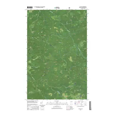
2016 Map of Ray SW
USGS Topo · Published 2016About this map
The Rat Root River meanders through this heavily forested landscape in northern Minnesota, defining the drainage patterns south of Rainy Lake. This 2016 survey illustrates a topography dominated by wetlands and low-lying areas, where the river and Beaver Brook serve as the primary natural landmarks. The human footprint is defined by a sparse network of rural roads, many of which carry family names like Budris Rd, Boyum Rd, and Biondich Rd. These routes provide access to the surrounding timberlands and remote acreage, marking the transition between localized land use and the broader wilderness of the North Woods. The map also delineates several township boundaries, including t68n r22w and t67n r23w, reflecting the long-established Public Land Survey System that still governs land ownership in this region.
Find a feature on this map
12 named features on this map. Tap any name to fly to it.
Don’t see what you’re looking for? This feature index may not catch every label — zoom into the map to look around manually.
Map Details
Editions of this 2016 Ray SW Map
This is the sole edition of this map. No revisions or reprints were ever made.
Other maps of this area

1954 · International Falls
USGS Topo · 1:250,000

1957 · International Falls
USGS Topo · 1:250,000

1958 · International Falls
USGS Topo · 1:250,000

1969 · Ray SE
USGS Topo · 1:24,000

1969 · Ericsburg
USGS Topo · 1:24,000

1969 · Ericsburg SE
USGS Topo · 1:24,000

1969 · Ray
USGS Topo · 1:24,000

1969 · Ray SW
USGS Topo · 1:24,000

1969 · Kabetogama
USGS Topo · 1:24,000

1969 · Nett Lake NE
USGS Topo · 1:24,000