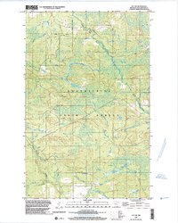
1999 Map of Ray SW
USGS Topo · Published 2003About this map
State Forest land dominates this section of Koochiching County, where the landscape is defined by the winding course of the Rat Root River. The terrain is shaped by the complex hydrology of northern Minnesota, with Beaver Creek and numerous wetlands branching across the wooded territory. While the area lacks dense settlements, the presence of a Winter Trail highlights the seasonal nature of movement through this environment, likely facilitating timber management or local transit when the ground is frozen. The inclusion of a Gravel Pit indicates small-scale resource extraction amidst the extensive forest cover, suggesting a landscape primarily dedicated to conservation and natural resource utility at the turn of the millennium.
Find a feature on this map
6 named features on this map. Tap any name to fly to it.
Don’t see what you’re looking for? This feature index may not catch every label — zoom into the map to look around manually.
Map Details
Editions of this 1999 Ray SW Map
This is the sole edition of this map. No revisions or reprints were ever made.
Other maps of this area

1954 · International Falls
USGS Topo · 1:250,000

1957 · International Falls
USGS Topo · 1:250,000

1958 · International Falls
USGS Topo · 1:250,000

1969 · Ray SE
USGS Topo · 1:24,000

1969 · Ericsburg
USGS Topo · 1:24,000

1969 · Ericsburg SE
USGS Topo · 1:24,000

1969 · Ray
USGS Topo · 1:24,000

1969 · Ray SW
USGS Topo · 1:24,000

1969 · Kabetogama
USGS Topo · 1:24,000

1969 · Nett Lake NE
USGS Topo · 1:24,000