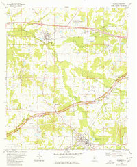
1980 Map of Raymond
USGS Topo · Published 1980About this map
The town of Raymond serves as a prominent focal point in this 1980 survey, home to the campus of Hinds Jr College and surrounded by a network of rural churches and cemeteries that speak to the deep-rooted local history of Hinds County. To the north, the settlement of Bolton sits along the Illinois Central Gulf Railroad, which runs parallel to an active Oil Field and several clay and sand pits. This landscape reveals the intersection of academic, religious, and industrial life, with institutions like Central Hinds Academy and St Thomas Sch alongside family landmarks like Davis Hill Cem and Gaddis Chapel.
Find a feature on this map
53 named features on this map. Tap any name to fly to it.
Don’t see what you’re looking for? This feature index may not catch every label — zoom into the map to look around manually.
Map Details
Editions of this 1980 Raymond Map
2 editions found
Other maps of this area

1903 · Jackson
USGS Topo · 1:125,000

1934 · Raymond
USGS Topo · 1:48,000

1937 · Raymond
USGS Topo · 1:62,500

1937 · Terry
USGS Topo · 1:48,000

1938 · Edwards
USGS Topo · 1:62,500

1942 · Raymond
USGS Topo · 1:62,500

1943 · Terry
USGS Topo · 1:62,500

1955 · Jackson
USGS Topo · 1:250,000

1961 · Jackson
USGS Topo · 1:250,000

1962 · Jackson
USGS Topo · 1:250,000