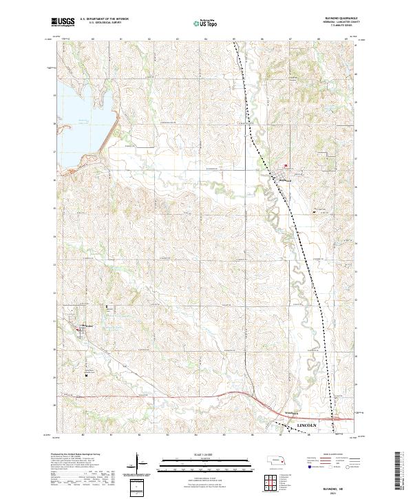
2021 Map of Raymond
USGS Topo · Published 2021About this map
The village of Raymond serves as the focal point of this survey, situated where the meandering Oak Creek flows through the central hills of Lancaster County. The landscape is defined by its agrarian patterns and critical water management, anchored by the significant Branched Oak Lake in the northwest and the Bradley South Reservoir further south. These features reveal the regional reliance on creek drainage systems, including Elk Cr and Little Salt Cr, to support the surrounding farmstead network.
Find a feature on this map
46 named features on this map. Tap any name to fly to it.
Don’t see what you’re looking for? This feature index may not catch every label — zoom into the map to look around manually.
Map Details
Editions of this 2021 Raymond Map
This is the sole edition of this map. No revisions or reprints were ever made.
Other maps of this area

1897 · Lincoln
USGS Topo · 1:125,000

1899 · Wahoo
USGS Topo · 1:125,000

1955 · Fremont
USGS Topo · 1:250,000

1955 · Lincoln
USGS Topo · 1:250,000

1957 · Fremont
USGS Topo · 1:250,000

1957 · Lincoln
USGS Topo · 1:250,000

1958 · Fremont
USGS Topo · 1:250,000

1958 · Lincoln
USGS Topo · 1:250,000
1964 · Garland
USGS Topo · 1:24,000
1964 · Pleasant Dale
USGS Topo · 1:24,000