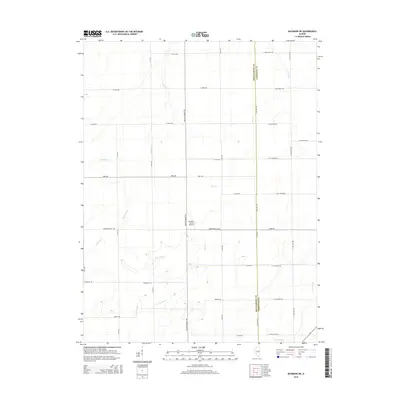
2015 Map of Raymond NE
USGS Topo · Published 2015About this map
Montgomery and Christian counties meet in this agricultural landscape defined by a dense grid of rural roads and the meandering paths of several key waterways. The northern reaches of the W Fork Shoal Cr and the Prairie Fork provide natural drainage for the surrounding fields, while Macoupin Cr and Horse Cr cut through the western portion of the quadrangle. The region is predominantly defined by its section-line road network, including notable thoroughfares like Black Diamond Trl and Mine Ave. Local aviation is represented by the presence of the Murphy Farms Airport, situated near the center of the survey area. This 2015 study captures the modern layout of these Illinois prairie lands, documenting the relationship between established family farm tracts and the natural creek systems that have shaped the local topography for generations.
Find a feature on this map
36 named features on this map. Tap any name to fly to it.
Don’t see what you’re looking for? This feature index may not catch every label — zoom into the map to look around manually.
Map Details
Editions of this 2015 Raymond NE Map
This is the sole edition of this map. No revisions or reprints were ever made.
Other maps of this area

1922 · Divernon
USGS Topo · 1:62,500

1923 · Taylorville
USGS Topo · 1:62,500

1923 · Raymond
USGS Topo · 1:62,500

1924 · Divernon
USGS Topo · 1:62,500

1925 · Taylorville
USGS Topo · 1:62,500

1925 · Raymond
USGS Topo · 1:62,500

1946 · Nokomis
USGS Topo · 1:62,500

1949 · Nokomis
USGS Topo · 1:62,500

1958 · Decatur
USGS Topo · 1:250,000

1961 · Decatur
USGS Topo · 1:250,000