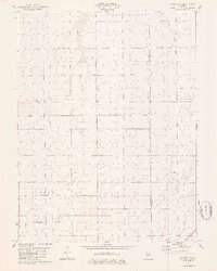
1979 Map of Raymond NE
USGS Topo · Published 1980About this map
Agricultural patterns and section-line roads dominate this Central Illinois landscape, where the Montgomery Co Christian Co boundary intersects the surrounding townships. The area is characterized by the convergence of several waterways, including the winding course of Macoupin Creek and the headwaters of Horse Creek, Clear Creek, and Prairie Fork. These drainages break up the otherwise uniform grid of the prairie, creating natural corridors through Bois D' Arc, King, Pitman, and Harvel.
Find a feature on this map
11 named features on this map. Tap any name to fly to it.
Don’t see what you’re looking for? This feature index may not catch every label — zoom into the map to look around manually.
Map Details
Editions of this 1979 Raymond NE Map
This is the sole edition of this map. No revisions or reprints were ever made.
Other maps of this area

1922 · Divernon
USGS Topo · 1:62,500

1923 · Taylorville
USGS Topo · 1:62,500

1923 · Raymond
USGS Topo · 1:62,500

1924 · Divernon
USGS Topo · 1:62,500

1925 · Taylorville
USGS Topo · 1:62,500

1925 · Raymond
USGS Topo · 1:62,500

1946 · Nokomis
USGS Topo · 1:62,500

1949 · Nokomis
USGS Topo · 1:62,500

1958 · Decatur
USGS Topo · 1:250,000

1961 · Decatur
USGS Topo · 1:250,000