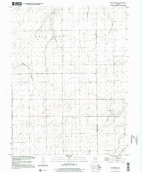
1998 Map of Raymond NE
USGS Topo · Published 2002About this map
Bois D' Arc and Harvel townships define the agricultural character of this central Illinois landscape at the close of the twentieth century. The map reveals a strictly organized section-line road network that segments the terrain between the Montgomery and Christian County line. Waterways like Horse Creek and Macoupin Creek meander through the prairie, providing the only breaks in the geometric grid of farmland. A notable transportation feature is the Seitz Landing Strip located in the eastern portion of the quadrangle near Clear Creek. The survey also marks a pipeline corridor crossing the southeastern quadrant. This 1998 imagery-derived update provides a precise look at the rural drainage systems, including the headwaters of the Prairie Fork, and the persistent township boundaries of King and Pitman that have governed local land use for generations.
Find a feature on this map
11 named features on this map. Tap any name to fly to it.
Don’t see what you’re looking for? This feature index may not catch every label — zoom into the map to look around manually.
Map Details
Editions of this 1998 Raymond NE Map
This is the sole edition of this map. No revisions or reprints were ever made.
Other maps of this area

1922 · Divernon
USGS Topo · 1:62,500

1923 · Taylorville
USGS Topo · 1:62,500

1923 · Raymond
USGS Topo · 1:62,500

1924 · Divernon
USGS Topo · 1:62,500

1925 · Taylorville
USGS Topo · 1:62,500

1925 · Raymond
USGS Topo · 1:62,500

1946 · Nokomis
USGS Topo · 1:62,500

1949 · Nokomis
USGS Topo · 1:62,500

1958 · Decatur
USGS Topo · 1:250,000

1961 · Decatur
USGS Topo · 1:250,000