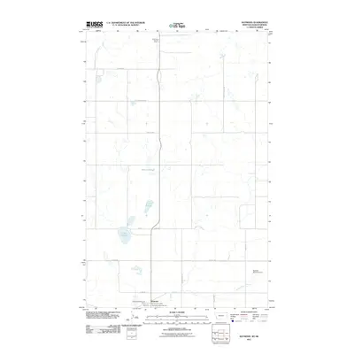
2011 Map of Raymond
USGS Topo · Published 2011About this map
Raymond Port of Entry stands as a focal point at the international border in this Sheridan County landscape, where the flat prairie is marked by a network of seasonal water bodies and local agricultural infrastructure. The settlement of Raymond is centered around the Raymond Post Office, Raymond Community Hall, and the commercial operations of Shermont Electric and Grain.
Find a feature on this map
20 named features on this map. Tap any name to fly to it.
Don’t see what you’re looking for? This feature index may not catch every label — zoom into the map to look around manually.
Map Details
Editions of this 2011 Raymond Map
This is the sole edition of this map. No revisions or reprints were ever made.
Other maps of this area

1954 · Wolf Point
USGS Topo · 1:250,000

1958 · Wolf Point
USGS Topo · 1:250,000

1983 · Plentywood NW
USGS Topo · 1:24,000

1983 · Dooley
USGS Topo · 1:24,000

1983 · Dooley SW
USGS Topo · 1:24,000

1983 · Plentywood
USGS Topo · 1:24,000

1983 · Raymond
USGS Topo · 1:24,000
1983 · Plentywood SW
USGS Topo · 1:24,000
2011 · Dooley
USGS Topo · 1:24,000
2011 · Plentywood SW
USGS Topo · 1:24,000