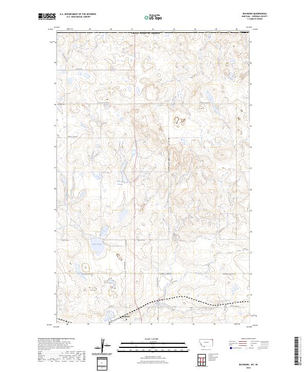
2024 Map of Raymond
USGS Topo · Published 2024About this map
The border community of Raymond anchors this portion of Sheridan County, Montana, situated directly south of the United States of America international boundary. This landscape is defined by the high plains topography of the Missouri Plateau, where drainage patterns are shaped by ephemeral water features like Mattson Slough and Syme Slough, alongside the winding course of McCoy Creek. The local infrastructure is deeply connected to the regional agricultural economy, evidenced by the network of section-line roads and the southern terminus of the town at Soo Line Rd. Named landmarks such as Chance Rd, Outlaw Coulee Rd, and Harrys Creek Rd reflect the early settlement history and the ranching heritage of this remote northern frontier. The town of Raymond remains a focal point with its Po serving the surrounding rural sections.
Find a feature on this map
21 named features on this map. Tap any name to fly to it.
Don’t see what you’re looking for? This feature index may not catch every label — zoom into the map to look around manually.
Map Details
Editions of this 2024 Raymond Map
This is the sole edition of this map. No revisions or reprints were ever made.
Other maps of this area

1954 · Wolf Point
USGS Topo · 1:250,000

1958 · Wolf Point
USGS Topo · 1:250,000

1983 · Plentywood NW
USGS Topo · 1:24,000

1983 · Dooley
USGS Topo · 1:24,000

1983 · Dooley SW
USGS Topo · 1:24,000

1983 · Plentywood
USGS Topo · 1:24,000

1983 · Raymond
USGS Topo · 1:24,000
1983 · Plentywood SW
USGS Topo · 1:24,000
2011 · Dooley
USGS Topo · 1:24,000
2011 · Plentywood SW
USGS Topo · 1:24,000