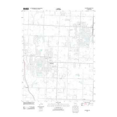
2011 Map of Raymore
USGS Topo · Published 2011About this map
Raymore serves as the central hub of this Missouri landscape, which is defined by a dense network of residential development and localized water management features. The area's transition toward suburban infrastructure is evident in the numerous artificial reservoirs, including Silverlake Enterprizes Lake, Raintree Lake, and the specifically titled Welborn Development Incorporated Lake. These water bodies are situated among the headwaters of the East Branch South Grand River and Middle Big Creek, reflecting a managed hydraulic environment.
Find a feature on this map
45 named features on this map. Tap any name to fly to it.
Don’t see what you’re looking for? This feature index may not catch every label — zoom into the map to look around manually.
Map Details
Editions of this 2011 Raymore Map
This is the sole edition of this map. No revisions or reprints were ever made.
Other maps of this area

1887 · Harrisonville
USGS Topo · 1:125,000

1887 · Olathe
USGS Topo · 1:125,000

1892 · Harrisonville
USGS Topo · 1:125,000

1893 · Olathe
USGS Topo · 1:125,000

1894 · Harrisonville
USGS Topo · 1:125,000

1934 · Grandview
USGS Topo · 1:24,000

1934 · Lees Summit
USGS Topo · 1:24,000

1934 · Woods Chapel
USGS Topo · 1:24,000

1939 · Grandview
USGS Topo · 1:31,680

1939 · Lees Summit
USGS Topo · 1:31,680