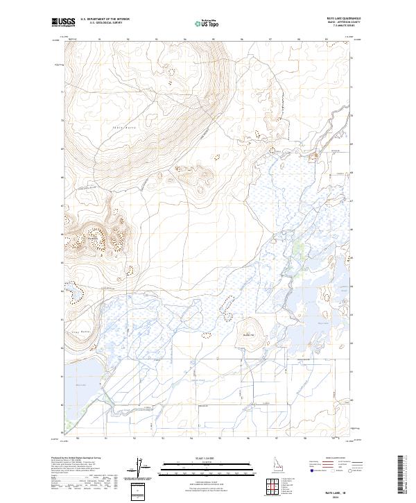
2024 Map of Rays Lake
USGS Topo · Published 2024About this map
Camas National Wildlife Refuge and the North Lake Wildlife Management Area dominate this high-desert landscape in Jefferson County. The terrain is defined by a complex hydrologic network where Camas Creek feeds into expansive wetland systems including Rays Lake and the eastern edge of Mud Lake. This area represents a critical intersection of natural water bodies and early 21st-century agricultural infrastructure, evidenced by the Independent Ditch, Jackett Canal, and Holly Canal that crisscross the lowlands.
Find a feature on this map
29 named features on this map. Tap any name to fly to it.
Don’t see what you’re looking for? This feature index may not catch every label — zoom into the map to look around manually.
Map Details
Editions of this 2024 Rays Lake Map
This is the sole edition of this map. No revisions or reprints were ever made.
Other maps of this area

1955 · Dubois
USGS Topo · 1:250,000

1955 · Idaho Falls
USGS Topo · 1:250,000

1958 · Dubois
USGS Topo · 1:250,000

1958 · Idaho Falls
USGS Topo · 1:250,000

1964 · Terreton
USGS Topo · 1:24,000
1964 · Market Lake
USGS Topo · 1:24,000

1964 · Cedar Butte SW
USGS Topo · 1:24,000

1964 · Mud Lake SE
USGS Topo · 1:24,000
1964 · Hamer
USGS Topo · 1:24,000

1964 · Mud Lake NW
USGS Topo · 1:24,000