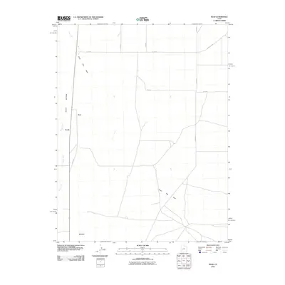
2010 Map of Read
USGS Topo · Published 2010About this map
The Beaver River and the broad alluvial flats of Beaver Bottoms define this section of Millard County, Utah. The landscape is characterized by intermittent drainage systems, including the aptly named Negro Mag Wash and Cove Creek, which cut across a grid of rural section roads. Settlement is sparse, represented by small named locales such as Read, Smyths, and Murdock. This area reflects the mid-century agricultural and transit patterns of western Utah, where a rigid network of numbered county roads like W 17300 S and S 22500 W imposed order on the arid terrain. The proximity of Black Rock Rd in the northeast corner hints at the regional connections to nearby volcanic landmarks and geological features typical of the Escalante Desert region.
Find a feature on this map
15 named features on this map. Tap any name to fly to it.
Don’t see what you’re looking for? This feature index may not catch every label — zoom into the map to look around manually.
Map Details
Editions of this 2010 Read Map
This is the sole edition of this map. No revisions or reprints were ever made.
Other maps of this area

1885 · Beaver
USGS Topo · 1:250,000

1953 · Richfield
USGS Topo · 1:250,000

1958 · Richfield
USGS Topo · 1:250,000

1958 · Milford
USGS Topo · 1:62,500

1958 · Milford
USGS Topo · 1:24,000

1958 · Adamsville
USGS Topo · 1:62,500

1958 · Ranch Canyon
USGS Topo · 1:24,000

1960 · Beaver Lake Mts.
USGS Topo · 1:62,500

1973 · Pinnacle Pass
USGS Topo · 1:24,000

1973 · Antelope Spring
USGS Topo · 1:24,000