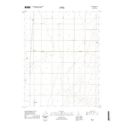
2020 Map of Read
USGS Topo · Published 2020About this map
Beaver Bottoms and the winding course of the Beaver River define the western portion of this landscape at the edge of the Escalante Desert. The terrain transitions from these river lowlands into the vast, open desert plains, marked by drainage features such as Negro Mag Wash and Cove Cr. This 2020 map documents the rural infrastructure connecting the isolated settlements of Read and Murdock, which are situated along the north-south transport corridor. The boundary between Millard Co and Beaver Co bisects the area, highlighting the jurisdictional divide in this arid basin. The map illustrates a grid of secondary roads, including W 17300 South St and S 23500 West St, that service the scattered outposts and agricultural operations clinging to the river’s drainage system.
Find a feature on this map
14 named features on this map. Tap any name to fly to it.
Don’t see what you’re looking for? This feature index may not catch every label — zoom into the map to look around manually.
Map Details
Editions of this 2020 Read Map
This is the sole edition of this map. No revisions or reprints were ever made.
Other maps of this area

1885 · Beaver
USGS Topo · 1:250,000

1953 · Richfield
USGS Topo · 1:250,000

1958 · Richfield
USGS Topo · 1:250,000

1958 · Milford
USGS Topo · 1:62,500

1958 · Milford
USGS Topo · 1:24,000

1958 · Adamsville
USGS Topo · 1:62,500

1958 · Ranch Canyon
USGS Topo · 1:24,000

1960 · Beaver Lake Mts.
USGS Topo · 1:62,500

1973 · Pinnacle Pass
USGS Topo · 1:24,000

1973 · Antelope Spring
USGS Topo · 1:24,000