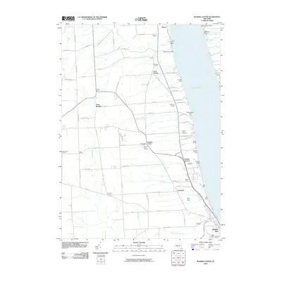
2010 Map of Reading Center
USGS Topo · Published 2010About this map
The western shoreline of Seneca Lake defines the character of this region, where steep lakefront points and deep-cutting streams meet the agricultural uplands of Schuyler County. In the settlement of Reading Center, the proximity of the Old Reading Cemetery and Pleasant View Cemetery provides a focal point for genealogical research. The landscape transition from the water's edge at Coal Point and Salt Point up to the rural crossroads of North Reading and Coles Corners reveals a historical reliance on both the lake and the local road network. Further south, the map captures the northern edges of Watkins Glen, including Saint Marys Cemetery and Greenwood Cemetery. The inclusion of several wineries, such as Fulkerson Winery and Lakewood Vineyards, underscores the long-standing viticultural identity of the Finger Lakes region.
Find a feature on this map
91 named features on this map. Tap any name to fly to it.
Don’t see what you’re looking for? This feature index may not catch every label — zoom into the map to look around manually.
Map Details
Editions of this 2010 Reading Center Map
This is the sole edition of this map. No revisions or reprints were ever made.
Other maps of this area

1898 · Watkins Glen
USGS Topo · 1:62,500

1901 · Watkins
USGS Topo · 1:62,500

1902 · Ovid
USGS Topo · 1:62,500

1903 · Penn Yan
USGS Topo · 1:62,500

1903 · Hammondsport
USGS Topo · 1:62,500

1905 · Watkins Glen
USGS Topo · 1:125,000

1942 · Dundee
USGS Topo · 1:24,000

1942 · Lodi
USGS Topo · 1:24,000

1942 · Keuka Park
USGS Topo · 1:24,000

1943 · Keuka Lake
USGS Topo · 1:31,680