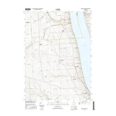
2016 Map of Reading Center
USGS Topo · Published 2016About this map
Reading Center and the surrounding hill country above the western shore of Seneca Lake define this landscape during the mid-2010s. The settlement pattern reflects deep-rooted rural lineages, marked by multiple historic burial grounds including Old Reading Cem, Pleasant View Cem, and Rock Stream Cem. The terrain is deeply incised by drainages such as Big Stream and Rock Stream as they descend toward the lake, creating notable points along the shoreline like Fir Tree Point and Salt Point.
Find a feature on this map
100 named features on this map. Tap any name to fly to it.
Don’t see what you’re looking for? This feature index may not catch every label — zoom into the map to look around manually.
Map Details
Editions of this 2016 Reading Center Map
This is the sole edition of this map. No revisions or reprints were ever made.
Other maps of this area

1898 · Watkins Glen
USGS Topo · 1:62,500

1901 · Watkins
USGS Topo · 1:62,500

1902 · Ovid
USGS Topo · 1:62,500

1903 · Penn Yan
USGS Topo · 1:62,500

1903 · Hammondsport
USGS Topo · 1:62,500

1905 · Watkins Glen
USGS Topo · 1:125,000

1942 · Dundee
USGS Topo · 1:24,000

1942 · Lodi
USGS Topo · 1:24,000

1942 · Keuka Park
USGS Topo · 1:24,000

1943 · Keuka Lake
USGS Topo · 1:31,680