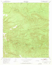
1950 Map of Reading Mountain
USGS Topo · Published 1975About this map
Reading Mountain and the high elevations of the Pinos Altos Range dominate this mid-century survey of Grant County. The topography is defined by sharp vertical relief, where ridges like Tadpole Ridge and Sheep Ridge divide deep drainage systems such as Reading Canyon and Holman Canyon. Human activity is sparse and tied directly to water sources, evidenced by the presence of Snow Creek Cabin near Snow Creek Spring and Allen Springs further south.
Find a feature on this map
32 named features on this map. Tap any name to fly to it.
Don’t see what you’re looking for? This feature index may not catch every label — zoom into the map to look around manually.
Map Details
Editions of this 1950 Reading Mountain Map
2 editions found

Other maps of this area

1909 · Silver City
USGS Topo · 1:125,000

1911 · Alum Mountain
USGS Topo · 1:125,000

1913 · Alum Mountain
USGS Topo · 1:125,000

1947 · Twin Sisters
USGS Topo · 1:24,000

1947 · Fort Bayard
USGS Topo · 1:24,000

1948 · Twin Sisters
USGS Topo · 1:24,000

1949 · Fort Bayard
USGS Topo · 1:24,000

1949 · Circle Mesa
USGS Topo · 1:24,000

1950 · Dorsey Ranch
USGS Topo · 1:24,000

1950 · Silver City
USGS Topo · 1:24,000