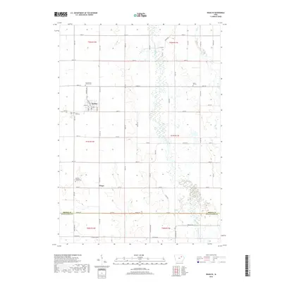
2018 Map of Readlyn
USGS Topo · Published 2018About this map
Readlyn sits at the heart of this agricultural landscape in northeastern Iowa, where a network of gravel and paved roads follows the strict section lines of the Public Land Survey System. The town center is complemented by the smaller settlement of Klinger further south. The Wapsipinicon River meanders through the eastern half of the map, its riparian wetlands creating a distinct contrast to the surrounding productive fields. Genealogists will find this particular survey highly valuable for its detailed indexing of rural burial grounds, including Saint Mathews Lutheran Cem, Emanuel Evangelical Lutheran Cem, and the Grove Hill Cem. These sites, along with others like Saint Pauls Cem and Zions Cem, reflect the strong denominational heritage and early settlement patterns of the families who established farms across the Bremer County and Black Hawk County border.
Find a feature on this map
62 named features on this map. Tap any name to fly to it.
Don’t see what you’re looking for? This feature index may not catch every label — zoom into the map to look around manually.
Map Details
Editions of this 2018 Readlyn Map
This is the sole edition of this map. No revisions or reprints were ever made.
Other maps of this area

1954 · Waterloo
USGS Topo · 1:250,000

1955 · Waterloo
USGS Topo · 1:250,000

1963 · Denver
USGS Topo · 1:24,000

1963 · Waterloo North
USGS Topo · 1:24,000

1971 · Readlyn
USGS Topo · 1:24,000

1971 · Sumner
USGS Topo · 1:24,000

1971 · Sumner SW
USGS Topo · 1:24,000

1971 · Dunkerton
USGS Topo · 1:24,000

1971 · Fairbank
USGS Topo · 1:24,000

1971 · Tripoli
USGS Topo · 1:24,000