2022 Map of Readstown
USGS Topo · Published 2022About this map
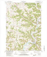
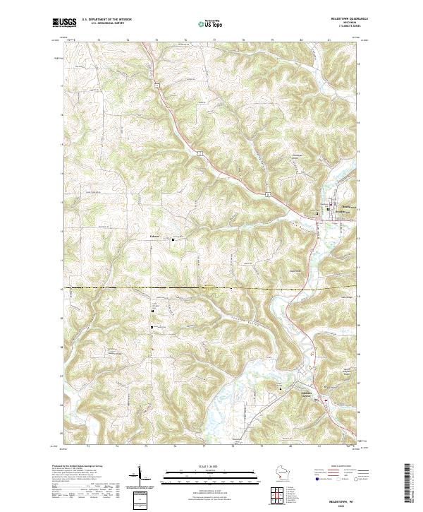
The Kickapoo River winds through this section of the Driftless Area, anchoring the settlements of Readstown and Soldiers Grove as it flows south. This 2022 survey captures the geographic boundary between Vernon County and Crawford County, a region defined by steep ridges and narrow valleys. Genealogists will find a high concentration of burial sites, including Carter Cem, Readstown Cem, and the South Kickapoo Cem near the riverbanks. The map also documents the smaller community of Folsom and named landmarks such as Eagle Rock and Briggs Point. The intricate network of local routes like Soldiers Grove Rd and Readstown Ridge Rd follows the winding topography, illustrating the enduring relationship between the area's difficult terrain and its transportation corridors.
Find a feature on this map
105 named features on this map. Tap any name to fly to it.
Don’t see what you’re looking for? This feature index may not catch every label — zoom into the map to look around manually.
Map Details
Editions of this 2022 Readstown Map
This is the sole edition of this map. No revisions or reprints were ever made.