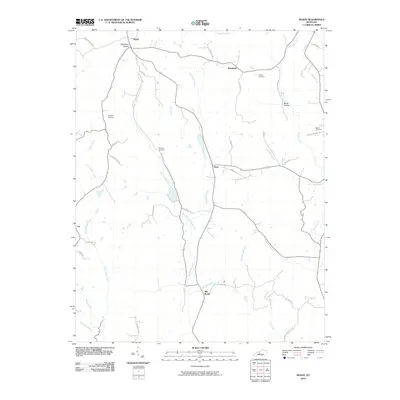
2010 Map of Ready
USGS Topo · Published 2010About this map
Ready and the surrounding rural communities of Grayson County are defined by a complex drainage system feeding into Big Reedy Creek. At the time of this 2010 survey, the landscape was largely agricultural and wooded, marked by scattered family settlements like Windyville, Nash, and Lee. Genealogy and local history researchers will find several well-established burial grounds, including the Preston Cemetery, Bethel Cemetery, and multiple locations of Woosley Cemetery. The terrain is characterized by its numerous small waterways and named hollows, such as Woodbury Hollow and Rowe Hollow, which have long dictated the path of local roads like Ready Jackson Rd and Beech Grove Rd. The map illustrates a modern snapshot of a classic Kentucky rural landscape where the placement of homes and farmsteads follows the contours of the West Fork Big Reedy Creek and Sunfish Creek.
Find a feature on this map
45 named features on this map. Tap any name to fly to it.
Don’t see what you’re looking for? This feature index may not catch every label — zoom into the map to look around manually.
Map Details
Editions of this 2010 Ready Map
This is the sole edition of this map. No revisions or reprints were ever made.
Other maps of this area

1914 · Little Muddy
USGS Topo · 1:62,500

1922 · Leitchfield
USGS Topo · 1:48,000

1922 · Brownsville
USGS Topo · 1:62,500

1923 · Brownsville
USGS Topo · 1:62,500

1925 · Spring Lick
USGS Topo · 1:62,500

1925 · Leitchfield
USGS Topo · 1:62,500

1953 · Ready
USGS Topo · 1:24,000

1953 · Bee Spring
USGS Topo · 1:24,000

1954 · Evansville
USGS Topo · 1:250,000

1954 · Spring Lick
USGS Topo · 1:24,000