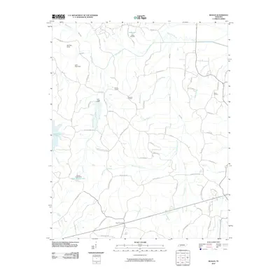
2010 Map of Reagan
USGS Topo · Published 2010About this map
Reagan Post Office anchors this rural landscape in Henderson County, serving a network of family-named roads and remote farmsteads. The terrain is defined by the winding course of the Beech River and its tributaries, including Cane Creek and Lost Creek, which have been modified by several small impoundments such as the Hesse Lake Dam and Robert L Hopkins Dam. These water management features, alongside the Beech River Slough, reflect the local efforts to control the drainage of the fertile bottomlands.
Find a feature on this map
66 named features on this map. Tap any name to fly to it.
Don’t see what you’re looking for? This feature index may not catch every label — zoom into the map to look around manually.
Map Details
Editions of this 2010 Reagan Map
This is the sole edition of this map. No revisions or reprints were ever made.
Other maps of this area

1936 · Lexington
USGS Topo · 1:24,000

1936 · Scotts Hill
USGS Topo · 1:24,000

1936 · Parsons
USGS Topo · 1:24,000

1936 · Thurman
USGS Topo · 1:24,000

1936 · Sardis
USGS Topo · 1:24,000

1936 · Reagan
USGS Topo · 1:24,000

1936 · Enville
USGS Topo · 1:24,000

1936 · Life
USGS Topo · 1:24,000

1936 · Chesterfield
USGS Topo · 1:24,000
1949 · Sardis
USGS Topo · 1:24,000