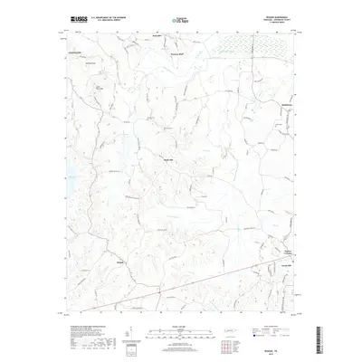
2019 Map of Reagan
USGS Topo · Published 2019About this map
Beech River and its intricate drainage network, including Cane Cr and Lost Cr, define the topography of this Henderson County landscape. The area is characterized by several distinct high points, such as Big Pine Knob and Little Pine Knob, which overlook a distribution of rural settlements and family-named landmarks. Small communities like Warrens Bluff, Reagan, and Shady Hill are connected by a web of local roads, reflecting a long-standing agricultural and residential pattern. Genealogists will find significant value in the documentation of several local burial sites, including Buckley Cem, New Hope Cem, and Powers Cem. The southern edge of the survey shows the residential clusters of Scotts Hill and Taylors Crossing, while the northern reach features Hesse Lake and the marshy expanses of the Beech River Slough.
Find a feature on this map
95 named features on this map. Tap any name to fly to it.
Don’t see what you’re looking for? This feature index may not catch every label — zoom into the map to look around manually.
Map Details
Editions of this 2019 Reagan Map
This is the sole edition of this map. No revisions or reprints were ever made.
Other maps of this area

1936 · Lexington
USGS Topo · 1:24,000

1936 · Scotts Hill
USGS Topo · 1:24,000

1936 · Parsons
USGS Topo · 1:24,000

1936 · Thurman
USGS Topo · 1:24,000

1936 · Sardis
USGS Topo · 1:24,000

1936 · Reagan
USGS Topo · 1:24,000

1936 · Enville
USGS Topo · 1:24,000

1936 · Life
USGS Topo · 1:24,000

1936 · Chesterfield
USGS Topo · 1:24,000
1949 · Sardis
USGS Topo · 1:24,000