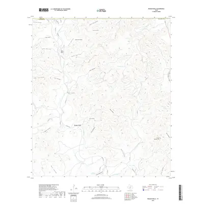
2019 Map of Reagan Wells
USGS Topo · Published 2019About this map
Reagan Wells serves as the central hub of this Uvalde County landscape, situated where the Dry Frio River carves through a complex network of canyons and ridges. The topography is defined by dozens of deeply incised drainages, including Mine Hollow, Bailey Hollow, and Fulghum Hollow, which collect into the primary river valleys. Family history and local heritage are anchored by the Cummins - Heard Cem, while the Flying J Ranch Airport indicates modern transportation access in this remote portion of the Texas Hill Country. To the east, the terrain rises toward Devils Backbone Mtn, overlooking the convergence of Mouser Cr and the main Frio River channel. The abundance of named springs and seasonal creeks, such as Lightning Bug Spring and Brushy Cr, highlights the critical importance of water sources in this limestone-dominated environment.
Find a feature on this map
52 named features on this map. Tap any name to fly to it.
Don’t see what you’re looking for? This feature index may not catch every label — zoom into the map to look around manually.
Map Details
Editions of this 2019 Reagan Wells Map
This is the sole edition of this map. No revisions or reprints were ever made.
Other maps of this area

1898 · Uvalde
USGS Topo · 1:125,000

1899 · Uvalde
USGS Topo · 1:125,000

1954 · San Antonio
USGS Topo · 1:250,000

1956 · Utopia
USGS Topo · 1:62,500

1957 · San Antonio
USGS Topo · 1:250,000

1957 · York Hollow
USGS Topo · 1:62,500

1960 · Concan
USGS Topo · 1:24,000

1960 · Magers Crossing
USGS Topo · 1:24,000
1969 · Rio Frio
USGS Topo · 1:24,000
1971 · Sycamore Mountain
USGS Topo · 1:24,000