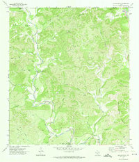
1971 Map of Reagan Wells
USGS Topo · Published 1974About this map
Reagan Wells serves as the primary hub of this 1971 topographical study, situated at the confluence of the Frio River and several drainage hollows. The landscape is defined by the winding paths of the Dry Frio River and the West Prong Frio River, which carve through the limestone terrain of the Balcones Escarpment. Notable family and community landmarks, such as the Cummins Heard Cemetery and the Heard Community Center, provide significant touchpoints for genealogical research. The presence of Devils Backbone Mountain and numerous springs like Buffalo Spring and Cedar Lick Spring illustrates a complex hydrological network typical of the Texas Hill Country. To the east, a portion of Garner State Park is visible, while the western reaches are marked by isolated features such as a Landing Strip and various small-scale operations like a Mine and Gravel Pit.
Find a feature on this map
42 named features on this map. Tap any name to fly to it.
Don’t see what you’re looking for? This feature index may not catch every label — zoom into the map to look around manually.
Map Details
Editions of this 1971 Reagan Wells Map
This is the sole edition of this map. No revisions or reprints were ever made.
Other maps of this area

1898 · Uvalde
USGS Topo · 1:125,000

1899 · Uvalde
USGS Topo · 1:125,000

1954 · San Antonio
USGS Topo · 1:250,000

1956 · Utopia
USGS Topo · 1:62,500

1957 · San Antonio
USGS Topo · 1:250,000

1957 · York Hollow
USGS Topo · 1:62,500

1960 · Concan
USGS Topo · 1:24,000

1960 · Magers Crossing
USGS Topo · 1:24,000
1969 · Rio Frio
USGS Topo · 1:24,000
1971 · Sycamore Mountain
USGS Topo · 1:24,000