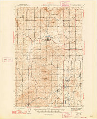
1945 Map of Reardan
USGS Topo · Published 1945About this map
The railroad junction at Reardan anchors this mid-century portrait of the Lincoln County plateau, where the Northern Pacific and Great Northern lines intersect the Sunset Highway. The landscape is defined by its agricultural community hubs, including the Spring Creek Grange and the West Deep Creek Grange, which served as social centers for the surrounding wheat country. The survey captures a network of rural education and memorial sites, from District School No 1 in the northwest to the Pleasant View Cem. A notable piece of aviation history is recorded near Magnison Butte, where a grounded Airway Beacon assisted pilots navigating the inland empire. Small grain-stop settlements like Waucon, Hite, and Edwall trace the rail corridors, while the drainages of Crab Creek and Deep Creek carve through the basalt-heavy terrain.
Find a feature on this map
24 named features on this map. Tap any name to fly to it.
Don’t see what you’re looking for? This feature index may not catch every label — zoom into the map to look around manually.
Map Details
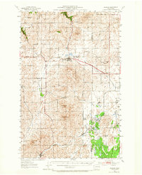
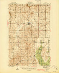
Editions of this 1945 Reardan Map
2 editions found