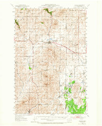
1953 Map of Reardan
USGS Topo · Published 1965About this map
Reardan sits at the nexus of the Sunset Highway and the Northern Pacific railroad, serving as a primary hub in eastern Lincoln County during the early 1950s. The landscape is defined by the transitions between the wheat-growing scablands and the intermittent flow of Crab Creek and Deep Creek. While larger towns like Edwall and Espanola mark the rail corridors, the surrounding countryside is dotted with community centers such as Spring Creek Grange and Waukon Grange, reflecting the vital social fabric of rural Washington at mid-century.
Find a feature on this map
27 named features on this map. Tap any name to fly to it.
Don’t see what you’re looking for? This feature index may not catch every label — zoom into the map to look around manually.
Map Details
Editions of this 1953 Reardan Map
2 editions found
Other maps of this area

1943 · Medical Lake
USGS Topo · 1:62,500

1944 · Clayton
USGS Topo · 1:62,500

1944 · Wellpinit
USGS Topo · 1:62,500

1945 · Reardan
USGS Topo · 1:62,500

1948 · Turtle Lake
USGS Topo · 1:62,500

1950 · Turtle Lake
USGS Topo · 1:62,500

1950 · Clayton
USGS Topo · 1:62,500

1953 · Reardan
USGS Topo · 1:62,500

1953 · Wellpinit
USGS Topo · 1:62,500

1953 · Ritzville
USGS Topo · 1:250,000