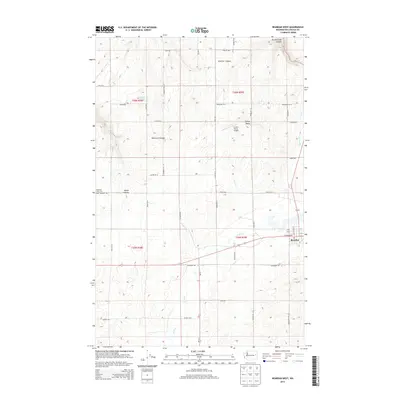
2014 Map of Reardan West
USGS Topo · Published 2014About this map
The town of Reardan anchors the southeastern corner of this landscape, situated along a network of section-line roads that define the region's agricultural character. This Lincoln County territory is marked by a series of dramatic geographic features, including Smeltzer Canyon and Spring Creek Canyon, which cut through the high plains. The drainage patterns of Crab Cr and Spring Cr create distinct corridors through the farm and ranch lands. Local aviation history is represented by the Zwainz Farms Airport, while genealogical researchers can locate the Pleasant View Cem near Squaw Canyon. The map reveals a highly structured rural grid, with family-named routes such as Riffe Rd and Schumer Rd N providing access to outlying acreage and landmarks like Gettys Butte and Laupp Lake.
Find a feature on this map
47 named features on this map. Tap any name to fly to it.
Don’t see what you’re looking for? This feature index may not catch every label — zoom into the map to look around manually.
Map Details
Editions of this 2014 Reardan West Map
This is the sole edition of this map. No revisions or reprints were ever made.
Other maps of this area

1944 · Wellpinit
USGS Topo · 1:62,500

1945 · Reardan
USGS Topo · 1:62,500

1948 · Turtle Lake
USGS Topo · 1:62,500

1950 · Turtle Lake
USGS Topo · 1:62,500

1953 · Reardan
USGS Topo · 1:62,500

1953 · Wellpinit
USGS Topo · 1:62,500

1953 · Ritzville
USGS Topo · 1:250,000

1955 · Spokane
USGS Topo · 1:250,000

1958 · Spokane
USGS Topo · 1:250,000

1959 · Ritzville
USGS Topo · 1:250,000