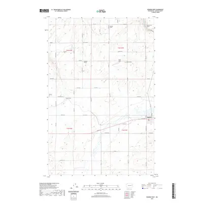
2020 Map of Reardan West
USGS Topo · Published 2020About this map
The town of Reardan sits at a critical junction of the Sunset Hwy E and W Broadway St, anchoring the southeastern corner of this Lincoln County survey. The landscape is defined by the erosion of the Columbia Plateau, where several prominent coulees and canyons like Smeltzer Canyon, Squaw Canyon, and Tamarack Canyon cut through the terrain. These geographical features, along with the intermittent flow of Crab Cr, dictate the placement of rural homesteads and agricultural roads throughout the region.
Find a feature on this map
56 named features on this map. Tap any name to fly to it.
Don’t see what you’re looking for? This feature index may not catch every label — zoom into the map to look around manually.
Map Details
Editions of this 2020 Reardan West Map
This is the sole edition of this map. No revisions or reprints were ever made.
Other maps of this area

1944 · Wellpinit
USGS Topo · 1:62,500

1945 · Reardan
USGS Topo · 1:62,500

1948 · Turtle Lake
USGS Topo · 1:62,500

1950 · Turtle Lake
USGS Topo · 1:62,500

1953 · Reardan
USGS Topo · 1:62,500

1953 · Wellpinit
USGS Topo · 1:62,500

1953 · Ritzville
USGS Topo · 1:250,000

1955 · Spokane
USGS Topo · 1:250,000

1958 · Spokane
USGS Topo · 1:250,000

1959 · Ritzville
USGS Topo · 1:250,000