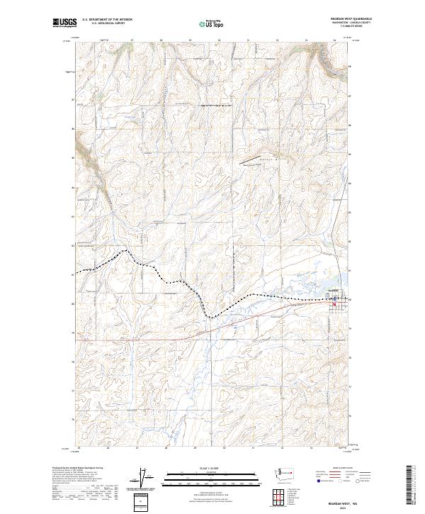
2023 Map of Reardan West
USGS Topo · Published 2023About this map
Reardan sits at the eastern edge of this agricultural landscape in Lincoln County, where the transition from high plateau to carved drainages defines the local geography. The town's grid meets Sunset Hwy E, a primary transit corridor that parallels the path of Crab Creek. North of the town, the terrain becomes increasingly complex as numerous canyons, including Laupp Canyon, Tamarack Canyon, and Smeltzer Canyon, cut through the high ground toward the Columbia River basin. A notable landmark in this rural area is Gettys Butte, which rises near the Zwainz Farms Airport. For genealogists and local historians, the Pleasant View Cem at the junction of Four Corners Rd E and Bald Ridge Rd N serves as a significant record of the families who settled this wheat-growing region.
Find a feature on this map
55 named features on this map. Tap any name to fly to it.
Don’t see what you’re looking for? This feature index may not catch every label — zoom into the map to look around manually.
Map Details
Editions of this 2023 Reardan West Map
This is the sole edition of this map. No revisions or reprints were ever made.
Other maps of this area

1944 · Wellpinit
USGS Topo · 1:62,500

1945 · Reardan
USGS Topo · 1:62,500

1948 · Turtle Lake
USGS Topo · 1:62,500

1950 · Turtle Lake
USGS Topo · 1:62,500

1953 · Reardan
USGS Topo · 1:62,500

1953 · Wellpinit
USGS Topo · 1:62,500

1953 · Ritzville
USGS Topo · 1:250,000

1955 · Spokane
USGS Topo · 1:250,000

1958 · Spokane
USGS Topo · 1:250,000

1959 · Ritzville
USGS Topo · 1:250,000