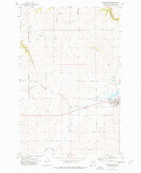
1973 Map of Reardan West
USGS Topo · Published 1977About this map
Reardan serves as the focal point of this Eastern Washington landscape, situated along the Burlington Northern line. The map illustrates a transition from the agricultural plateaus to the deeply incised drainage systems characteristic of the region, including Tamarack Canyon, Smeltzer Canyon, and Squaw Canyon. These geological features, alongside Bald Ridge and Gettys Butte, dictate the local transport and water patterns, with Crab Creek and Laupp Lake providing critical water sources in an otherwise arid environment.
Find a feature on this map
21 named features on this map. Tap any name to fly to it.
Don’t see what you’re looking for? This feature index may not catch every label — zoom into the map to look around manually.
Map Details
Editions of this 1973 Reardan West Map
This is the sole edition of this map. No revisions or reprints were ever made.
Other maps of this area

1944 · Wellpinit
USGS Topo · 1:62,500

1945 · Reardan
USGS Topo · 1:62,500

1948 · Turtle Lake
USGS Topo · 1:62,500

1950 · Turtle Lake
USGS Topo · 1:62,500

1953 · Reardan
USGS Topo · 1:62,500

1953 · Wellpinit
USGS Topo · 1:62,500

1953 · Ritzville
USGS Topo · 1:250,000

1955 · Spokane
USGS Topo · 1:250,000

1958 · Spokane
USGS Topo · 1:250,000

1959 · Ritzville
USGS Topo · 1:250,000