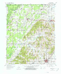
1958 Map of Rector
USGS Topo · Published 1978About this map
The St Louis Southwestern RR cuts through the lowlands of the Mississippi Valley, anchoring a landscape defined by an extensive drainage network in the late 1950s. The town of Rector serves as a primary hub in the southeast, while smaller settlements like McDougal and Pollard dot the northern reaches near the Missouri border. This survey reveals a deeply established rural community, evidenced by a high density of country churches and family-named cemeteries, including Cummings Chapel, Blooming Grove Ch, and Trovillion Cem. The complex system of numbered ditches and flumes, such as Ditch No 19 and Ditch No 25, demonstrates the mid-century engineering required to manage the wetlands surrounding the Black River and Cache River. These waterways, along with features like Fish Trap Slough, highlight the importance of water management to the agricultural life of Clay County.
Find a feature on this map
84 named features on this map. Tap any name to fly to it.
Don’t see what you’re looking for? This feature index may not catch every label — zoom into the map to look around manually.
Map Details
Editions of this 1958 Rector Map
2 editions found

Other maps of this area

1934 · Kennett
USGS Topo · 1:62,500

1935 · Acorn
USGS Topo · 1:62,500

1935 · Rector
USGS Topo · 1:62,500

1935 · Knobel
USGS Topo · 1:62,500

1935 · Harviell
USGS Topo · 1:62,500

1940 · Naylor
USGS Topo · 1:62,500

1940 · Gainesville
USGS Topo · 1:62,500

1940 · Marmaduke
USGS Topo · 1:62,500

1940 · Valley Ridge
USGS Topo · 1:62,500

1940 · Kennett
USGS Topo · 1:62,500