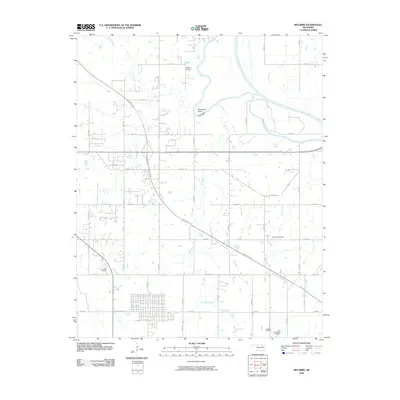
2010 Map of Red Bird
USGS Topo · Published 2010About this map
The Verdigris River snakes through this portion of Wagoner County, defined by its sharp meander at Horseshoe Bend. The landscape is a transition between the established river valley and the modern infrastructure of the Muskogee Tpke, which cuts diagonally across the terrain. For those tracing family histories in the area, several burial grounds are scattered across the quadrangle, including Hawkins Cemetery near the river and Gar Creek Cemetery further east. The local hydrology is well-defined by tributaries like Fife Creek, Gar Creek, and Strawberry Creek. A rigid grid of rural roads, such as N 4180 Rd and E 0730 Rd, organizes the residential and agricultural plots, while the street network of a larger settlement begins to emerge near W Boston Ave and N Main St.
Find a feature on this map
41 named features on this map. Tap any name to fly to it.
Don’t see what you’re looking for? This feature index may not catch every label — zoom into the map to look around manually.
Map Details
Editions of this 2010 Red Bird Map
This is the sole edition of this map. No revisions or reprints were ever made.
Other maps of this area

1896 · Okmulgee
USGS Topo · 1:125,000

1896 · Pryor
USGS Topo · 1:125,000

1900 · Okmulgee
USGS Topo · 1:125,000

1901 · Muscogee
USGS Topo · 1:125,000

1901 · Claremore
USGS Topo · 1:125,000

1901 · Pryor
USGS Topo · 1:125,000

1905 · Muscogee
USGS Topo · 1:125,000

1914 · Claremore
USGS Topo · 1:125,000

1916 · Claremore
USGS Topo · 1:125,000

1946 · Fort Smith
USGS Topo · 1:250,000