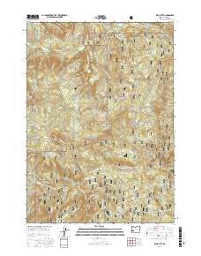
2017 Map of Red Butte
USGS Topo · Published 2017About this map
Umpqua National Forest defines this section of Douglas County, where the steep topography of the Cascade foothills is carved by an intricate network of waterways. The drainage of Little River and its numerous tributaries, including Wolf Creek and Cavitt Cr, dictates the layout of the landscape. High points like Red Butte and Sampson Butte rise above the timbered ridges, while natural landmarks such as Wolf Creek Falls and Shadow Falls indicate the sharp vertical drops common in this terrain.
Find a feature on this map
73 named features on this map. Tap any name to fly to it.
Don’t see what you’re looking for? This feature index may not catch every label — zoom into the map to look around manually.
Map Details
Editions of this 2017 Red Butte Map
This is the sole edition of this map. No revisions or reprints were ever made.
Other maps of this area

1897 · Roseburg
USGS Topo · 1:125,000

1900 · Roseburg
USGS Topo · 1:125,000

1954 · Dixonville
USGS Topo · 1:62,500

1954 · Glide
USGS Topo · 1:62,500

1955 · Red Butte
USGS Topo · 1:62,500

1955 · Mace Mtn
USGS Topo · 1:62,500

1958 · Roseburg
USGS Topo · 1:250,000

1959 · Roseburg
USGS Topo · 1:250,000

1978 · Diamond Lake
USGS Topo · 1:100,000

1979 · Roseburg
USGS Topo · 1:100,000