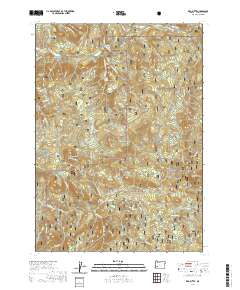
2020 Map of Red Butte
USGS Topo · Published 2020About this map
Umpqua National Forest dominates this section of the Oregon Cascades, defined by a complex network of ridges and watercourses. The landscape rises to prominent peaks including Red Butte and Sampson Butte, with Negro Ridge stretching across the eastern portion of the survey. Below these heights, the Little River and its numerous tributaries like Cavitt Cr and Wolf Cr carve through the terrain. Evidence of the area's recreational and forest management history is found in the dense network of forest roads and trails, such as the Wolf Creek Falls Trl and the Red Butte Tie. These paths lead to distinctive points of interest including Wolf Creek Falls and Shadow Falls, as well as high-altitude features like Sugar Pine Flat and Cavitt Lake. The map details the intersection of early 21st-century timber management roads and established natural landmarks.
Find a feature on this map
50 named features on this map. Tap any name to fly to it.
Don’t see what you’re looking for? This feature index may not catch every label — zoom into the map to look around manually.
Map Details
Editions of this 2020 Red Butte Map
This is the sole edition of this map. No revisions or reprints were ever made.
Other maps of this area

1897 · Roseburg
USGS Topo · 1:125,000

1900 · Roseburg
USGS Topo · 1:125,000

1954 · Dixonville
USGS Topo · 1:62,500

1954 · Glide
USGS Topo · 1:62,500

1955 · Red Butte
USGS Topo · 1:62,500

1955 · Mace Mtn
USGS Topo · 1:62,500

1958 · Roseburg
USGS Topo · 1:250,000

1959 · Roseburg
USGS Topo · 1:250,000

1978 · Diamond Lake
USGS Topo · 1:100,000

1979 · Roseburg
USGS Topo · 1:100,000