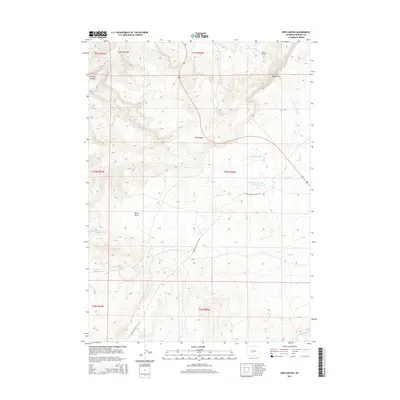
2015 Map of Red Canyon
USGS Topo · Published 2015About this map
Red Canyon cuts through the center of this Wyoming landscape, revealing the complex drainage systems of Fremont County. The terrain is defined by dramatic elevation shifts at Beaver Rim and the deep incisions of Wood Canyon and Reno Draw. Water management in this arid environment is evident through the placement of Jackson Reservoir and Antelope Springs Reservoir, which capture runoff from seasonal drainages like Antelope Cr and Little Antelope Cr.
Find a feature on this map
24 named features on this map. Tap any name to fly to it.
Don’t see what you’re looking for? This feature index may not catch every label — zoom into the map to look around manually.
Map Details
Editions of this 2015 Red Canyon Map
This is the sole edition of this map. No revisions or reprints were ever made.
Other maps of this area

1953 · Lewiston Lakes
USGS Topo · 1:24,000

1953 · Barras Springs
USGS Topo · 1:24,000

1953 · Sweetwater Station
USGS Topo · 1:24,000

1953 · Happy Spring
USGS Topo · 1:24,000

1953 · Schlichting Mountain
USGS Topo · 1:24,000

1953 · Dishpan Butte
USGS Topo · 1:24,000

1953 · Del Monte Ridge
USGS Topo · 1:24,000

1953 · Yellowstone Ranch
USGS Topo · 1:24,000

1953 · Red Canyon
USGS Topo · 1:24,000

1955 · Lander
USGS Topo · 1:250,000