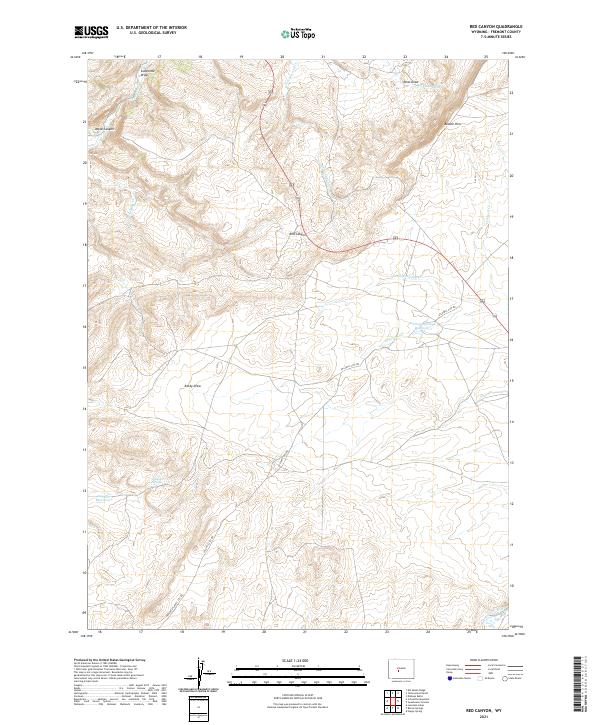
2021 Map of Red Canyon
USGS Topo · Published 2021About this map
Red Canyon and the high desert terrain of southern Fremont County dominate this 2021 study, where seasonal drainage systems and natural springs define the land's utility. The modern transition of historic paths is evident through the route of the Atlantic City Rd and the Hudson-Atlantic City Rd, which cross the high plateau toward the southern reaches of the quadrangle. Water remains the most critical resource in this arid landscape, anchored by the Sweetwater River at the southeastern corner and small upland developments like the Antelope Springs Reservoir and Jackson Reservoir. Along the dramatic escarpment of Beaver Rim, numerous named draws such as Reno Draw and Soap Hole Draw reveal the complex erosion patterns of the region. These features, along with localized water sources like Jackson Spring and Bain Spring, highlight the essential sites where grazing and transit would have clustered in this high-altitude environment.
Find a feature on this map
25 named features on this map. Tap any name to fly to it.
Don’t see what you’re looking for? This feature index may not catch every label — zoom into the map to look around manually.
Map Details
Editions of this 2021 Red Canyon Map
This is the sole edition of this map. No revisions or reprints were ever made.
Other maps of this area

1953 · Lewiston Lakes
USGS Topo · 1:24,000

1953 · Barras Springs
USGS Topo · 1:24,000

1953 · Sweetwater Station
USGS Topo · 1:24,000

1953 · Happy Spring
USGS Topo · 1:24,000

1953 · Schlichting Mountain
USGS Topo · 1:24,000

1953 · Dishpan Butte
USGS Topo · 1:24,000

1953 · Del Monte Ridge
USGS Topo · 1:24,000

1953 · Yellowstone Ranch
USGS Topo · 1:24,000

1953 · Red Canyon
USGS Topo · 1:24,000

1955 · Lander
USGS Topo · 1:250,000