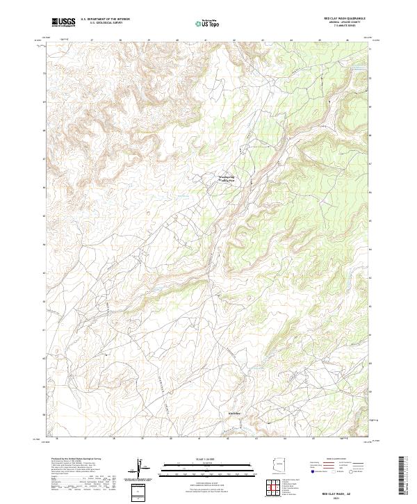
2021 Map of Red Clay Wash
USGS Topo · Published 2021About this map
Woodspring Trading Post stands as a focal point in this high-desert landscape of Apache County, where the high-elevation terrain is defined by an intricate network of seasonal drainage channels and vital springs. The settlement of Kinlichee lies in the southern portion of the map, connected by local routes such as Kinlichee School Rd and Kinlichee Rd. This area reflects a landscape where water and trade routes dictated the placement of outposts. Several named water features, including Wood Spring and White-around-the-Mountain Spring, appear as essential resources in this arid environment. The map also documents the drainage patterns of Lone Tule Wash, Sage House Wash, and Red Clay Wash, which carve through the land towards Kinlichee Cr. A complex system of Navajo Service and Indian Routes, such as Indian Rte 27 and Fluted Rock Rd, provide a modern record of the infrastructure connecting these high-plateau communities.
Find a feature on this map
29 named features on this map. Tap any name to fly to it.
Don’t see what you’re looking for? This feature index may not catch every label — zoom into the map to look around manually.
Map Details
Editions of this 2021 Red Clay Wash Map
This is the sole edition of this map. No revisions or reprints were ever made.
Other maps of this area

1886 · Fort Defiance
USGS Topo · 1:250,000

1892 · Fort Defiance
USGS Topo · 1:250,000

1954 · Gallup
USGS Topo · 1:250,000

1955 · Zith-Tusayan Butte 3 NW
USGS Topo · 1:24,000

1955 · Zith-Tusayan Butte 2 SE
USGS Topo · 1:24,000

1955 · Zith-Tusayan Butte 2 SW
USGS Topo · 1:24,000

1955 · Zith-Tusayan Butte 3 NE
USGS Topo · 1:24,000

1955 · Zith-Tusayan Butte 2 NW
USGS Topo · 1:24,000

1955 · Zith-Tusayan Butte 2 NE
USGS Topo · 1:24,000
1955 · Nazlini
USGS Topo · 1:62,500
Featured Places
- Chinle Agency, AZ
- Fort Defiance Agency
- Wood Springs, Chinle Agency
- Kinlichee, Fort Defiance Agency
- Apache County, AZ