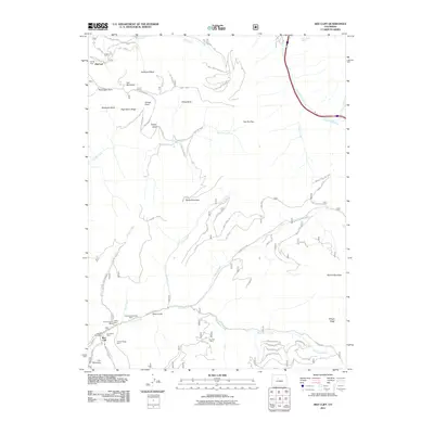
2011 Map of Red Cliff
USGS Topo · Published 2011About this map
Red Cliff sits along the Eagle River at the southern edge of this Eagle County landscape, a town defined by its mining history and proximity to the high peaks. The terrain is marked by legacy workings such as the Hornsilver Mine, Liberty Mine, and Iron Dike Mine, reflecting the mineral extraction that preceded the area's development into a recreation hub. To the north, the world-famous terrain of the Vail Ski Area dominates the slopes of Vail Mountain, including the expansive China Bowl, Sunup Bowl, and Northeast Bowl. This 2011 map contrasts the established industrial roots of the southern gulches with the modern infrastructure of the ski slopes at Mid Vail. Extensive forest service roads, including Shrine Pass Rd and Mill Creek Rd, weave through the high ridges, connecting the Turkey Creek drainage to prominent peaks like Shrine Mountain and Ptarmigan Point.
Find a feature on this map
65 named features on this map. Tap any name to fly to it.
Don’t see what you’re looking for? This feature index may not catch every label — zoom into the map to look around manually.
Map Details
Editions of this 2011 Red Cliff Map
This is the sole edition of this map. No revisions or reprints were ever made.
Other maps of this area

1889 · Leadville
USGS Topo · 1:125,000

1891 · Leadville
USGS Topo · 1:125,000

1929 · Dillon
USGS Topo · 1:62,500

1934 · Climax
USGS Topo · 1:48,000

1934 · Minturn
USGS Topo · 1:62,500

1934 · Dillon
USGS Topo · 1:62,500

1938 · Mt. Lincoln
USGS Topo · 1:48,000

1942 · Leadville
USGS Topo · 1:125,000

1945 · Mount Lincoln
USGS Topo · 1:62,500

1949 · Holy Cross
USGS Topo · 1:62,500