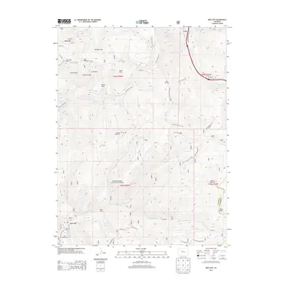
2013 Map of Red Cliff
USGS Topo · Published 2013About this map
Red Cliff sits along the Eagle River in this high-altitude survey of the central Colorado Rockies. The settlement serves as a gateway to the White River National Forest, where the landscape is defined by steep ridges and legendary alpine basins. To the north, the massive infrastructure of the Vail Ski Area is evident through complex trail networks and bowls such as China Bowl, Sundown Bowl, and Teacup Bowl. Local history is anchored by the Greenwood Cem and the Po in town, while the surrounding peaks like Battle Mountain and Iron Mountain suggest the area's mining and ranching heritage. A dense network of forest trails, including the Two Elk Trail 2005.1 and Shrine Mountain Trail 2016.1, underscores the transition from early resource extraction at Hornsilver and Clister Gulch to a modern economy centered on recreation and conservation.
Find a feature on this map
51 named features on this map. Tap any name to fly to it.
Don’t see what you’re looking for? This feature index may not catch every label — zoom into the map to look around manually.
Map Details
Editions of this 2013 Red Cliff Map
This is the sole edition of this map. No revisions or reprints were ever made.
Other maps of this area

1889 · Leadville
USGS Topo · 1:125,000

1891 · Leadville
USGS Topo · 1:125,000

1929 · Dillon
USGS Topo · 1:62,500

1934 · Climax
USGS Topo · 1:48,000

1934 · Minturn
USGS Topo · 1:62,500

1934 · Dillon
USGS Topo · 1:62,500

1938 · Mt. Lincoln
USGS Topo · 1:48,000

1942 · Leadville
USGS Topo · 1:125,000

1945 · Mount Lincoln
USGS Topo · 1:62,500

1949 · Holy Cross
USGS Topo · 1:62,500