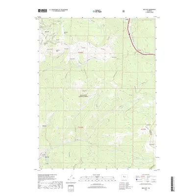
2019 Map of Red Cliff
USGS Topo · Published 2019About this map
Vail Ski Area and the high alpine terrain of the White River National Forest dominate this 2019 survey, revealing the complex infrastructure of one of America's premier mountain destinations. The map traces a dense network of trails and named bowls including Northeast Bowl, Sunup Bowl, and Teacup Bowl, alongside specialized service routes like the Vail Mountain Spur and Pete's Bowl Skiway.
Find a feature on this map
62 named features on this map. Tap any name to fly to it.
Don’t see what you’re looking for? This feature index may not catch every label — zoom into the map to look around manually.
Map Details
Editions of this 2019 Red Cliff Map
This is the sole edition of this map. No revisions or reprints were ever made.
Other maps of this area

1889 · Leadville
USGS Topo · 1:125,000

1891 · Leadville
USGS Topo · 1:125,000

1929 · Dillon
USGS Topo · 1:62,500

1934 · Climax
USGS Topo · 1:48,000

1934 · Minturn
USGS Topo · 1:62,500

1934 · Dillon
USGS Topo · 1:62,500

1938 · Mt. Lincoln
USGS Topo · 1:48,000

1942 · Leadville
USGS Topo · 1:125,000

1945 · Mount Lincoln
USGS Topo · 1:62,500

1949 · Holy Cross
USGS Topo · 1:62,500