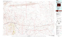
1980 Map of Red Desert Basin
USGS Topo · Published 1980About this map
The Continental Divide winds through this high desert landscape, marking a critical geographic spine in Southwestern Wyoming. By the late 1970s, the corridor along the Union Pacific railroad and Interstate 80 defined the region's human geography, connecting a string of small settlements and industrial outposts. Historically significant routes like the Overland Trail are visible, tracing a path south of the tracks through a territory of vast alkali flats and prominent geologic features. In the northwest, the Leucite Hills rise with distinctive landmarks such as Steamboat Mountain and Zirkel Mesa. The map captures the industrial character of the era, from the coal-mining roots of Superior and South Superior to the rail stops at Point of Rocks, Black Buttes, and Bitter Creek. This arid basin is further defined by its complex drainage systems, including Deadman Wash and Dugout Draw, which cut through the extensive Sand Dunes stretching across the northern horizon.
Find a feature on this map
59 named features on this map. Tap any name to fly to it.
Don’t see what you’re looking for? This feature index may not catch every label — zoom into the map to look around manually.
Map Details
Editions of this 1980 Red Desert Basin Map
This is the sole edition of this map. No revisions or reprints were ever made.
Other maps of this area

1908 · Rock Springs
USGS Topo · 1:62,500

1910 · Rock Springs
USGS Topo · 1:62,500

1954 · Rawlins
USGS Topo · 1:250,000

1954 · Rock Springs
USGS Topo · 1:250,000

1955 · Lander
USGS Topo · 1:250,000

1955 · Casper
USGS Topo · 1:250,000

1958 · Rawlins
USGS Topo · 1:250,000

1958 · Casper
USGS Topo · 1:250,000

1958 · Lander
USGS Topo · 1:250,000

1958 · Rock Springs
USGS Topo · 1:250,000