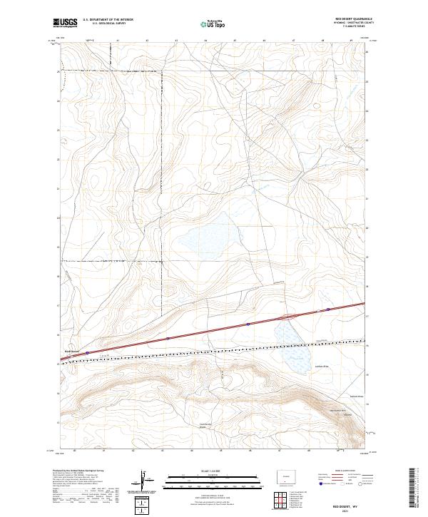
2021 Map of Red Desert
USGS Topo · Published 2021About this map
The Continental Divide traverses this high-altitude landscape in Sweetwater County, marking the hydrological crest of the Rockies. The small settlement of Red Desert sits along the southern edge of this map, positioned near the transport corridor that includes I-80 SVC RD and Rasmussen Rd. The region is defined by its arid drainage patterns and water management history, evidenced by the presence of Threemile Ditch and Fivemile Ditch in the northern townships. In the southeast, the terrain rises toward Wamsutter Rim and Big Hill, overlooking Latham Draw. This 2021 survey illustrates a sparse ranching and resource-heavy landscape where infrastructure like Frewen Rd provides access to remote interior areas such as Frewen Lake. The map provides a precise look at the township and range grid system essential for property research in this section of the Wyoming desert.
Find a feature on this map
19 named features on this map. Tap any name to fly to it.
Don’t see what you’re looking for? This feature index may not catch every label — zoom into the map to look around manually.
Map Details
Editions of this 2021 Red Desert Map
This is the sole edition of this map. No revisions or reprints were ever made.
Other maps of this area

1954 · Rawlins
USGS Topo · 1:250,000

1954 · Rock Springs
USGS Topo · 1:250,000

1958 · Rawlins
USGS Topo · 1:250,000

1958 · Rock Springs
USGS Topo · 1:250,000

1960 · Lost Creek Butte
USGS Topo · 1:62,500

1962 · Rawlins
USGS Topo · 1:250,000

1962 · Rock Springs
USGS Topo · 1:250,000

1966 · Wamsutter
USGS Topo · 1:24,000

1966 · Monument Lake
USGS Topo · 1:24,000

1966 · Eightmile Lake
USGS Topo · 1:24,000