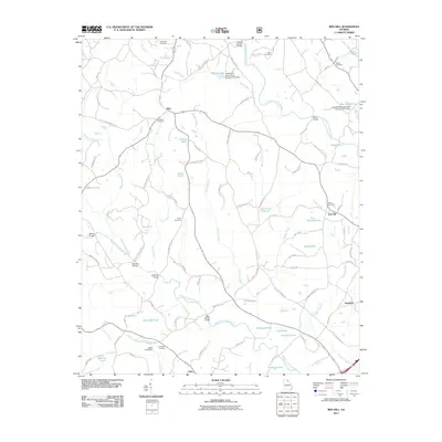
2011 Map of Red Hill
USGS Topo · Published 2011About this map
Mize and Red Hill anchor this rural landscape in Georgia's northeast, where the North Fork Broad River and Middle Fork Broad River carve through the terrain. The map reveals a dense network of water management features, including the North Fork Broad River Structure Six Dam and numerous private impoundments such as Pruitt Lake, Fulbright Pond, and Cagle Lake. This water-rich environment is crossed by several historical spans like the Silver Shoals Bridge and Williams Bridge, which connect a web of local routes including Broad River Church Rd and Farmers Academy Rd.
Find a feature on this map
102 named features on this map. Tap any name to fly to it.
Don’t see what you’re looking for? This feature index may not catch every label — zoom into the map to look around manually.
Map Details
Editions of this 2011 Red Hill Map
This is the sole edition of this map. No revisions or reprints were ever made.
Other maps of this area

1886 · Walhalla
USGS Topo · 1:125,000

1891 · Carnesville
USGS Topo · 1:125,000

1892 · Walhalla
USGS Topo · 1:125,000

1896 · Walhalla
USGS Topo · 1:125,000

1954 · Greenville
USGS Topo · 1:250,000

1958 · Greenville
USGS Topo · 1:250,000

1959 · Carnesville
USGS Topo · 1:24,000

1960 · Martin
USGS Topo · 1:24,000
1963 · Avalon
USGS Topo · 1:24,000
1964 · Ayersville
USGS Topo · 1:24,000