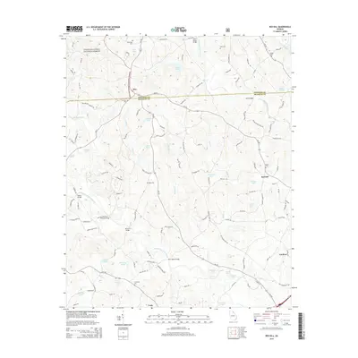
2014 Map of Red Hill
USGS Topo · Published 2014About this map
The boundary between Stephens and Franklin counties defines this Georgia landscape, where the Chattahoochee National Forest meets a network of small agricultural settlements. In the north, Mize serves as a central point near the Sunshine Cemetery, while the village of Red Hill anchors the eastern side of the map. The terrain is deeply carved by the Middle Fork Broad River and the North Fork Broad River, which are spanned by numerous crossings including the Silver Shoals Bridge and McFarlin Bridge.
Find a feature on this map
124 named features on this map. Tap any name to fly to it.
Don’t see what you’re looking for? This feature index may not catch every label — zoom into the map to look around manually.
Map Details
Editions of this 2014 Red Hill Map
This is the sole edition of this map. No revisions or reprints were ever made.
Other maps of this area

1886 · Walhalla
USGS Topo · 1:125,000

1891 · Carnesville
USGS Topo · 1:125,000

1892 · Walhalla
USGS Topo · 1:125,000

1896 · Walhalla
USGS Topo · 1:125,000

1954 · Greenville
USGS Topo · 1:250,000

1958 · Greenville
USGS Topo · 1:250,000

1959 · Carnesville
USGS Topo · 1:24,000

1960 · Martin
USGS Topo · 1:24,000
1963 · Avalon
USGS Topo · 1:24,000
1964 · Ayersville
USGS Topo · 1:24,000