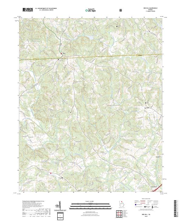
2024 Map of Red Hill
USGS Topo · Published 2024About this map
The Middle Fork Broad River and North Fork Broad River converge in this corner of Northeast Georgia, defining a landscape of rolling hills and dendritic stream networks. This contemporary survey reveals a rural character preserved by the Chattahoochee National Forest to the northwest and a scattering of small agrarian communities like Mize, Unity, and Red Hill. The area is deeply rooted in local history, as evidenced by numerous family and community burial grounds such as New Hope Cem, Sunshine Cem, and Culpepper Cem. The terrain is punctuated by an extensive system of ponds including Cagle Lake, Whiten Pond, and Sosby Pond, which suggests a history of land management and local agriculture near the Franklin County and Stephens County line. Modern road networks like the Old Stagecoach Rd trace the paths of long-established thoroughfares between Carnesville and Vandiver.
Find a feature on this map
137 named features on this map. Tap any name to fly to it.
Don’t see what you’re looking for? This feature index may not catch every label — zoom into the map to look around manually.
Map Details
Editions of this 2024 Red Hill Map
This is the sole edition of this map. No revisions or reprints were ever made.
Historical Maps of Double Churches Through Time
4 maps found