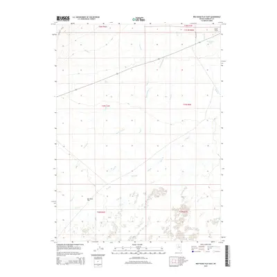
2015 Map of Red House Flat East
USGS Topo · Published 2015About this map
Clover Valley occupies the northeastern corner of this Nevada landscape, where the high desert terrain transitions into a complex drainage network. The area is defined by the sweeping expanse of Red House Flat in the southwest and a series of intermittent watercourses that traverse the sagebrush-covered plains. Notable among these are Kelly Cr, Granite Cr, and Summer Camp Cr, which flow toward the lower elevations of the basin. The map reveals the critical importance of water sources in this arid environment, highlighting Prosperous Pond and the aptly named Bug Brush Spring. Local infrastructure is sparse, centered on the corridor of Kelly Creek Rd and the route of Highway 789, which serves as a primary artery across this remote section of Humboldt County.
Find a feature on this map
19 named features on this map. Tap any name to fly to it.
Don’t see what you’re looking for? This feature index may not catch every label — zoom into the map to look around manually.
Map Details
Editions of this 2015 Red House Flat East Map
This is the sole edition of this map. No revisions or reprints were ever made.
Other maps of this area

1882 · Paradise
USGS Topo · 1:250,000

1893 · Paradise
USGS Topo · 1:250,000

1932 · Sonoma Range
USGS Topo · 1:250,000

1939 · Sonoma Range
USGS Topo · 1:250,000

1945 · Osgood Mountains
USGS Topo · 1:62,500

1947 · Osgood Mountains
USGS Topo · 1:62,500

1955 · McDermitt
USGS Topo · 1:250,000

1955 · Winnemucca
USGS Topo · 1:250,000

1958 · Winnemucca
USGS Topo · 1:250,000

1959 · McDermitt
USGS Topo · 1:250,000