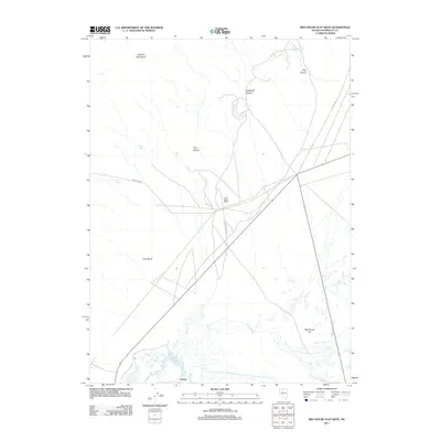
2011 Map of Red House Flat West
USGS Topo · Published 2011About this map
Hugh Bains Ranch sits at the center of this Great Basin landscape, situated where several primitive desert routes and modern roads intersect north of the Humboldt River. The southern portion of the map is defined by the braided path of the river and the marshy expanses of Kelly Creek, which meanders across the broad Red House Flat. To the north, the terrain rises into the southern reaches of the Osgood Mountains, characterized by deep seasonal drainages such as Hogshead Canyon and Felix Canyon. Important water sources in this arid environment include Garden Spring and Dog Spring, which likely served as critical stops along historical travel ways like Soldier Pass. The presence of the Comus settlement near the river bank suggests a localized focal point for regional activity near the railroad and water corridor.
Find a feature on this map
15 named features on this map. Tap any name to fly to it.
Don’t see what you’re looking for? This feature index may not catch every label — zoom into the map to look around manually.
Map Details
Editions of this 2011 Red House Flat West Map
This is the sole edition of this map. No revisions or reprints were ever made.
Other maps of this area

1882 · Paradise
USGS Topo · 1:250,000

1893 · Paradise
USGS Topo · 1:250,000

1932 · Sonoma Range
USGS Topo · 1:250,000

1939 · Sonoma Range
USGS Topo · 1:250,000

1945 · Osgood Mountains
USGS Topo · 1:62,500

1947 · Osgood Mountains
USGS Topo · 1:62,500

1955 · McDermitt
USGS Topo · 1:250,000

1955 · Winnemucca
USGS Topo · 1:250,000

1958 · Winnemucca
USGS Topo · 1:250,000

1959 · McDermitt
USGS Topo · 1:250,000